

Find your next favorite trail
Research for your weekend trip with trail photos, videos, marked campsite locations, community trail reviews, advanced difficulty ratings, and more.

Already have an account? Log In
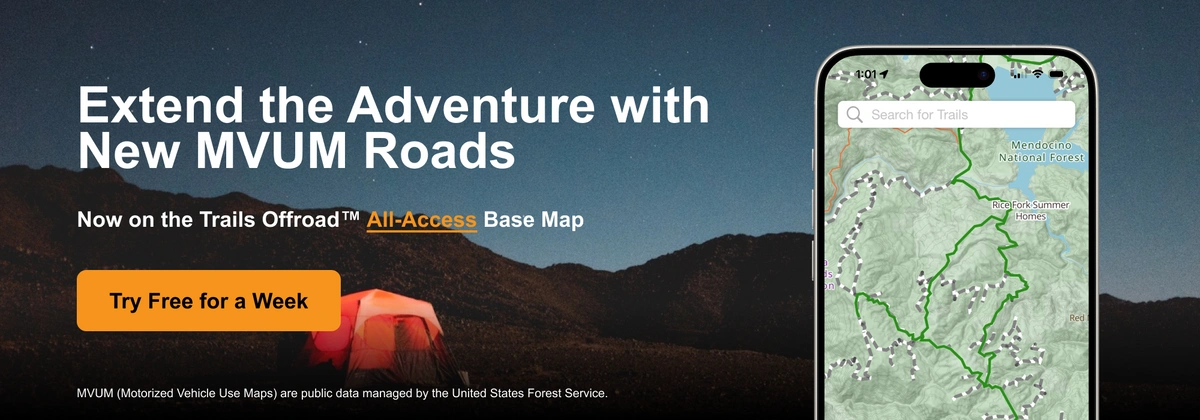
The team at Trails Offroad™ brings you the latest update to the most detailed offroad trail platform. All-Access members see thousands of vetted Trail Guides and Scout Routes along with newly included MVUM (Motorized Vehicle Use Maps) roads in national forests nationwide as part of the Trails Offroad™ All-Access Base Map. Available with a 7-day free trial.
Motor Vehicle Use Maps (MVUM) are comprehensive maps that provide essential information about the roads and trails managed by public land agencies, specifically the United States Forest Service. MVUM detail which routes are open to motorized vehicles, the types of vehicles allowed, and any seasonal restrictions. Essentially, MVUMs are your key to understanding and navigating the ever-changing landscape of offroad regulations and conditions in the national forests.
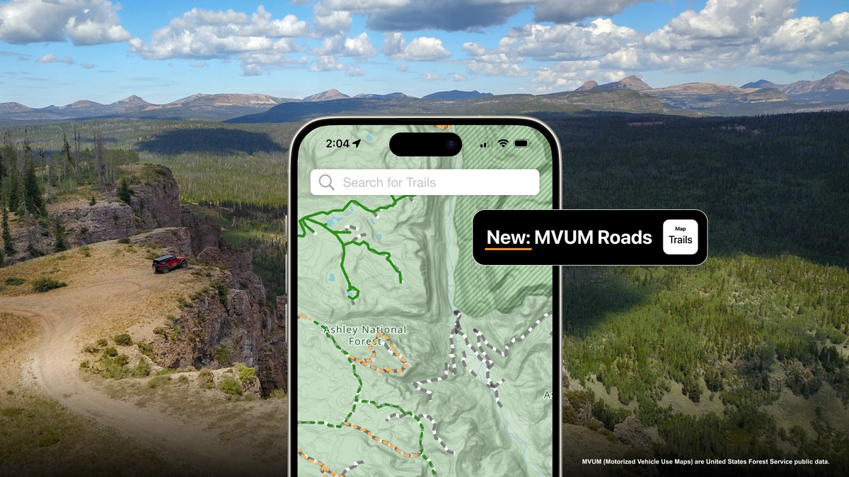
Our new MVUM feature takes trail research and navigation to a new level.
Interactive Road Information: Now, tap and hold on an MVUM road or trail within the Trails Offroad™ All-Access map to get instant, detailed information. Curious about the current status of a road? Just hold down on the map, and you’ll see information about its open dates, seasonal restrictions, and more.
Detailed Road Conditions: All trails are not created equal. While there might be USFS (United States Forest Service) roads suitable for passenger vehicles, some may require high clearance vehicles, while others are suitable for all types of offroaders.
Getting started easily with our new MVUM feature:
Open the Trails Offroad™ App or Website: Launch our app on your mobile device or open the Trails Offroad website on your computer.
Navigate to the Trail Map: Go to the trail map section where you usually plan your routes.
Tap and Hold: Locate a checkered pattern MVUM road within a national forest. Tap and hold on the map. A pop-up will appear with detailed information about the road status, conditions, and any restrictions.
Plan Your Adventure: Use the information provided to make informed decisions about your route and ensure a smooth and enjoyable offroad experience.
Understanding the nuances of road conditions and regulations is crucial for a successful offroad adventure. MVUM roads are the perfect companion to Trails Offroad™ Trail Guides and Scout Routes, helping you extend your adventure and connect our vetted trails to create long-form expeditions. Stay informed on the areas you’re exploring, any restrictions or requirements, and where legal motorized traffic is allowed. By adhering to USFS MVUM we, as an offroad community, operate as responsible stewards of public lands.
---
We’re excited to bring you this new feature and can’t wait to see how it enhances your offroad experiences. Whether you’re a seasoned trailblazer or new to the offroad world, the MVUM feature is here to make your adventures more informed and enjoyable.
Happy exploring, and see you on the trails!