Region

Kofa Wildlife Refuge

Arizona

Offroad Trails in Kofa Wildlife Refuge

A Region within Arizona
4.4/5 (157)

Are you tired of the hustle and bustle of life in the busy city? Do you need an escape from the crowds and a chance to live a more simplistic life? If picking up and moving isn't an option but you can sneak out for a long weekend away, Kofa National Wildlife Refuge is the place to go. It offers miles of beautiful, desolate dirt roads, historical abandoned mines and homesteads, and a stillness only the desert can offer.

Kofa is said to have the most geographically isolated camping and offroading in the entire state of Arizona. Many of the trails can lead you to remote areas over 50 miles from the nearest glimpse of modern civilization. What's even better, Kofa is home to some of the most unique landscapes found this side of Mars.

The rugged mountain ranges were once deeply coveted for their hidden mineral treasures, including gold, silver, and manganese. The remains of desolate mining operations can still be found in the area, as can a few original homesteads–some even available for short overnight stays. If you stumble upon any of these historical remains, please be respectful so they can continue to be enjoyed for generations to come.

For those planning to make the journey out into the Kofa National Wildlife Refuge, keep in mind that the remoteness brings increased risk. It's not recommended to travel alone and be sure to bring plenty of water as temperatures routinely exceed 100 degrees in the summer months. Most trails in the area are traversable in a stock or lightly modified 4WD vehicle, but be ready for unforeseen challenges and rapidly

Top Reasons to Explore Here
Beginner Category IconBeginner
Camping Category IconCamping
Desert Category IconDesert
Ghost Town Category IconGhost Town
Mine Category IconMine
Overland Category IconOverland
Sand Category IconSand
Scenic Category IconScenic
Wash Category IconWash
Trail Types
Scout Route
Full Trail Guide

Preview Trail Icon
Preview Trails
easy
moderate
difficult
severe
extreme

All-Access
Scout Route
Start a 7-day Free Trial

Most Recent Trail Reviews

Most Popular

Search for Trails
Arizona: El Paso Pipeline Road Hero Photo
All-Access Icon
4/5 (9 reviews)
Updated: 03/02/2024
El Paso Pipeline Road
Tonopah, Arizona

52 plus miles of dirt and you can avoid I-10, what more could you want? El Paso Pipeline Road plays a major part in building area offroad trips for the day, the weekend, or even longer routes connecting the Phoenix Valley and the Salton Sea. Beautiful desert landscapes filled with washes and jagged peaks are interrupted by pipeline markers and powerlines, but that should not stop you from wanting to use this road. Impressive views of the Eagletail Mountains Wilderness Area, including the mysterious-looking Courthouse Rock, greet you at either the beginning or the end of the trail depending on which direction you choose to drive it. Once you train your eyes to look past the utilities, you find all the opportunities for overland adventure that is abundant directly from this road. Tip: Up above, increase the "Nearby Trails" tab view to 35 miles to see the route potentials you can explore!

Arizona: Kofa Cabin - Jasper Springs Hero Photo
All-Access Icon
4.7/5 (11 reviews)
Updated: 02/25/2024
Kofa Cabin - Jasper Springs
Quartzsite, Arizona
Traveling deep into the Kofa National Wildlife Refuge, you slowly approach a very rugged and mysterious looking mountain range, the Kofa Mountains, from which the Refuge is aptly named. Kofa is a 666,640-acre wildlife refuge in Arizona established in 1939 to preserve the population of desert bighorn sheep and offers miles and miles of overland adventure. This road provides a slow and tantalizing reveal of the Kofa range that instills a sense of inspiring excitement with each glimpse on each turn and rewards you with no letdown but only inspiring views.
Arizona: Kofa Manganese Road Hero Photo
All-Access Icon
4.6/5 (15 reviews)
Updated: 03/02/2024
Kofa Manganese Road
Quartzsite, Arizona

Solitude. Jagged mountain horizons. Dark star-filled skies. Towering saguaro cacti. Broad desert plains. Sandy washes densely lined with ironwood, palo verde, and mesquite. Campfire smoke wafting skyward. Plaintive coyote songs in the night. Kofa Manganese offers all these in abundance. Threading a thin corridor between beautiful wilderness areas of the Kofa National Wildlife Refuge, Kofa Manganese climbs steadily to scenic Red Rock Pass. Squeezed between the ancient Kofa Mountains to the west and the rugged Little Horn Mountains to the east, views from the pass offers are simply astounding. The trail drops quickly after Red Rock Pass and begins weaving in and out of the wide meandering Hoodoo Wash. Leaving Hoodoo Wash, Kofa Manganese traces the edge of the broad Palomas Plain before angling westward towards the Kofa Mountains. Ocotillo cacti thrive in this area and stretch their thorny octopus arms skyward, some impressively over 25 feet tall. Cholla grows in dense gardens, beautifully silver-green in the sunlight. But beware. The thorns will make you say bad words. If you crave a remote wheeling adventure with tons of dramatic scenery, leave the crowds behind and head into southwestern Arizona's vast wilderness on the Kofa Manganese.

Arizona: Engesser Pass Hero Photo
All-Access Icon
4.8/5 (11 reviews)
Updated: 03/02/2024
Engesser Pass
Quartzsite, Arizona

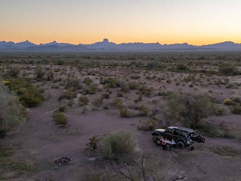
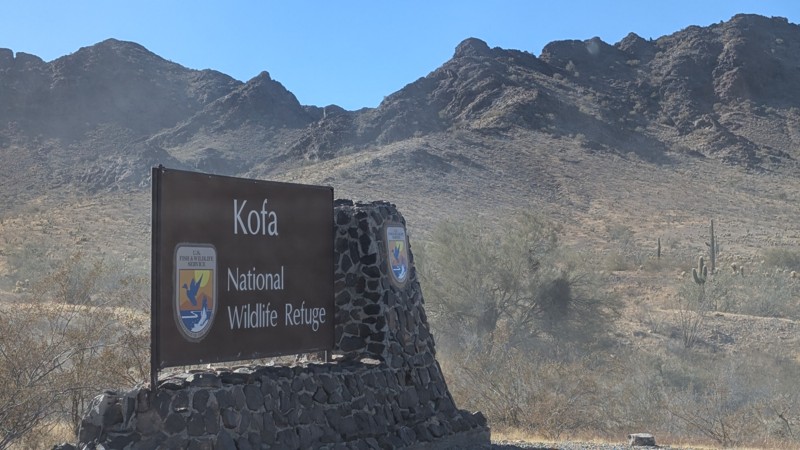
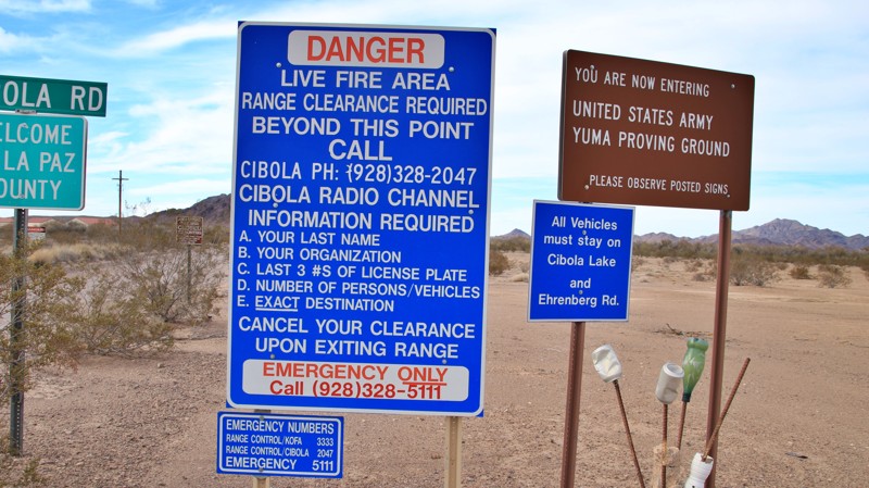
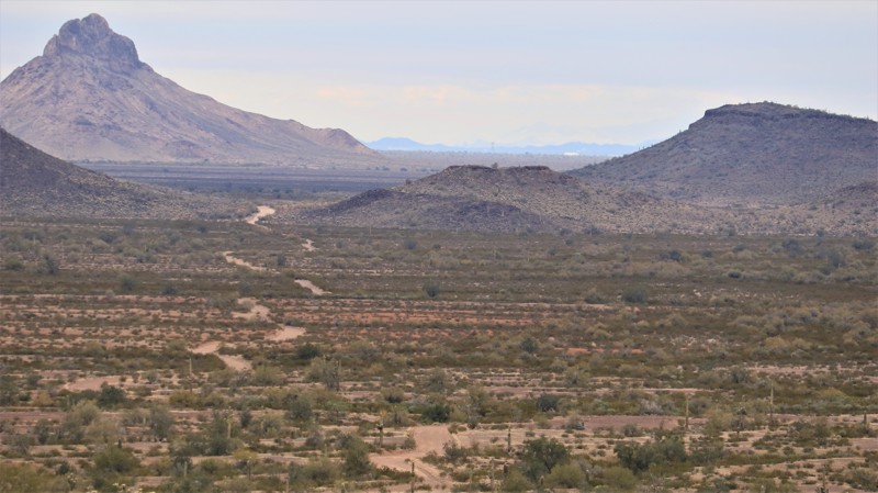
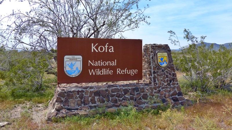
Engesser Pass is likely the most remote trail in Arizona based on travel distance to the nearest human habitation. Engesser Pass traverses the midsection of the beautifully rugged Kofa National Wildlife Refuge, which covers over 1,000 square miles with not a single human inhabitant. The 2,000 square miles of the Yuma Proving Grounds cradle the bottom of the refuge. No one lives there either since the Proving Ground is where the Marines test things that explode. Approximately 3,000 square miles of uninhabited BLM land lie east of the refuge. That is 6,000 square miles. Four states, Hawaii, Rhode Island, Delaware, and Connecticut, are smaller. In all that space, no human resides full-time. No light bulb burns at night. Very few roads exist. And in the middle of all that splendid remoteness is Engesser Pass. 
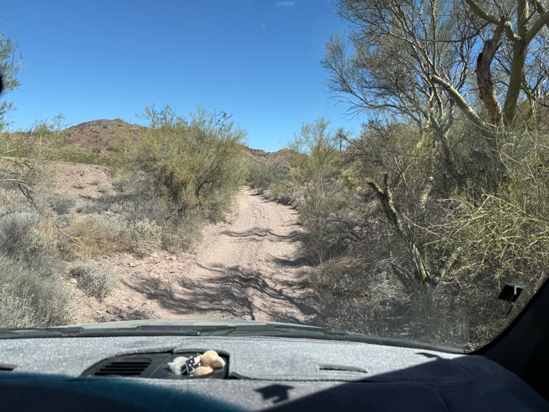
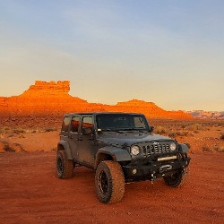
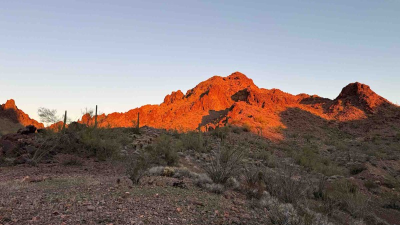
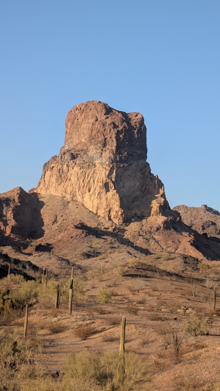
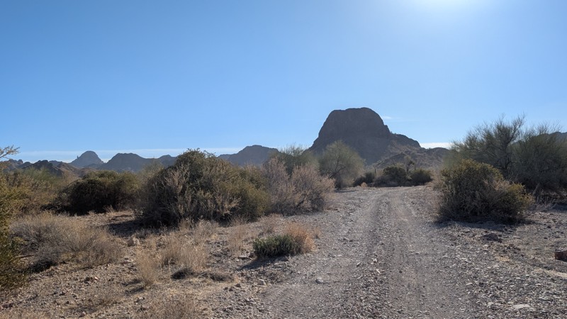
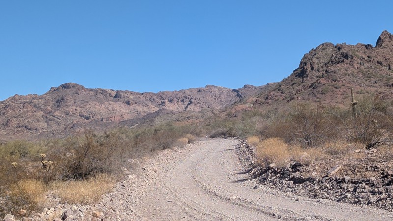
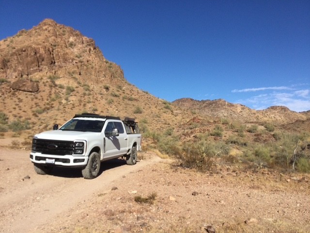
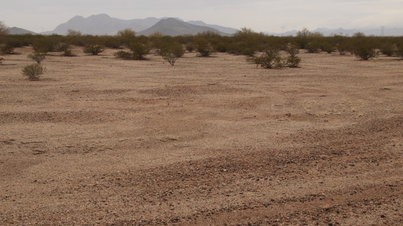
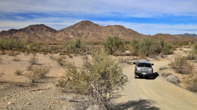
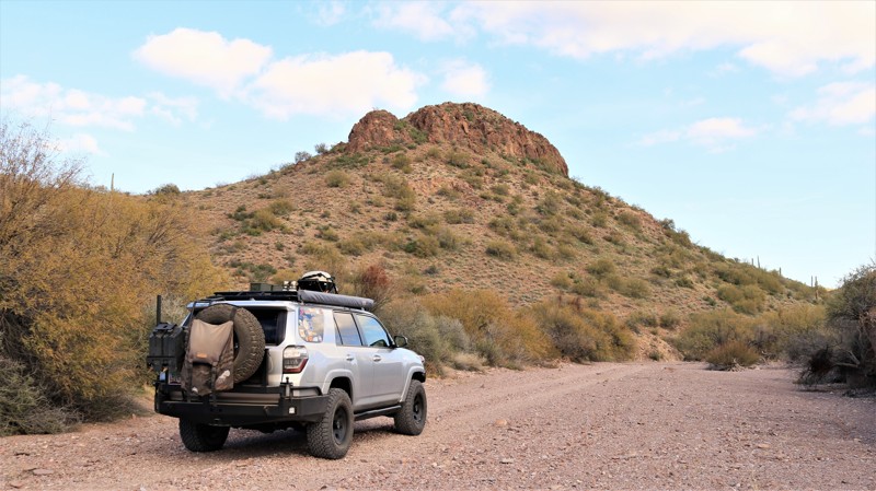
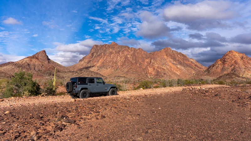
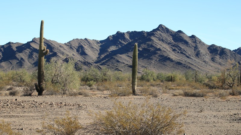
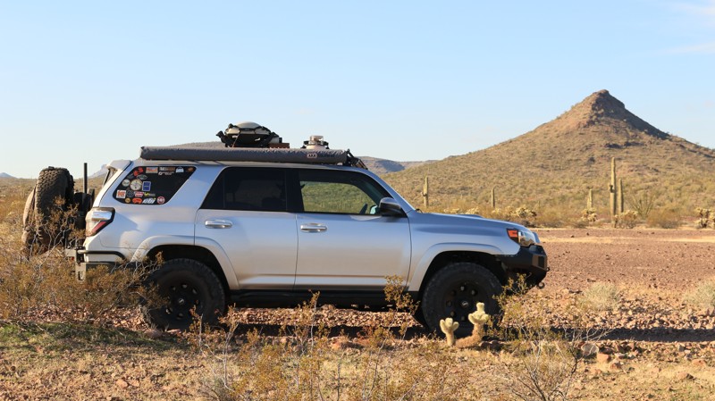
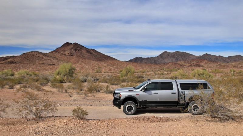
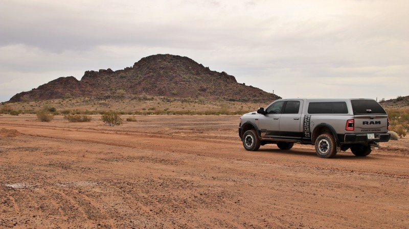
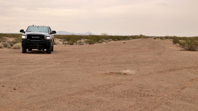
When traveled east to west, Engesser Pass begins as an easy two-track on a ridgeline above the vast saguaro-studded Palomas Plain to the east. Mountain ranges sawtooth the horizon in every direction, near and far. Ocotillos reach skyward, flaming red flowers on the ends of their long tendril shafts. Thickets of thorny silver cholla scatter their pin cushion droppings to painfully attach to the unwary. To the west looms the multi-hued sawtoothed Kofa Mountains. 
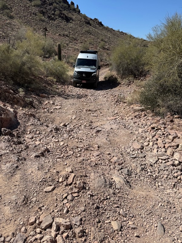
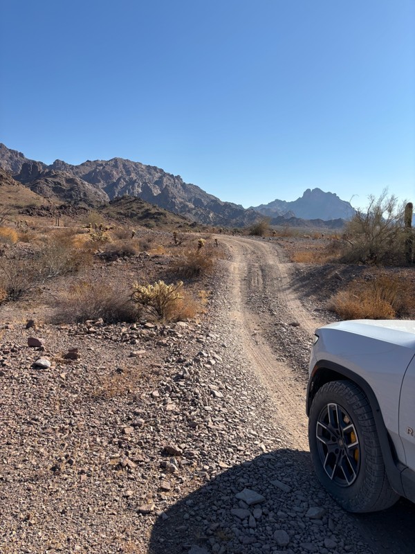
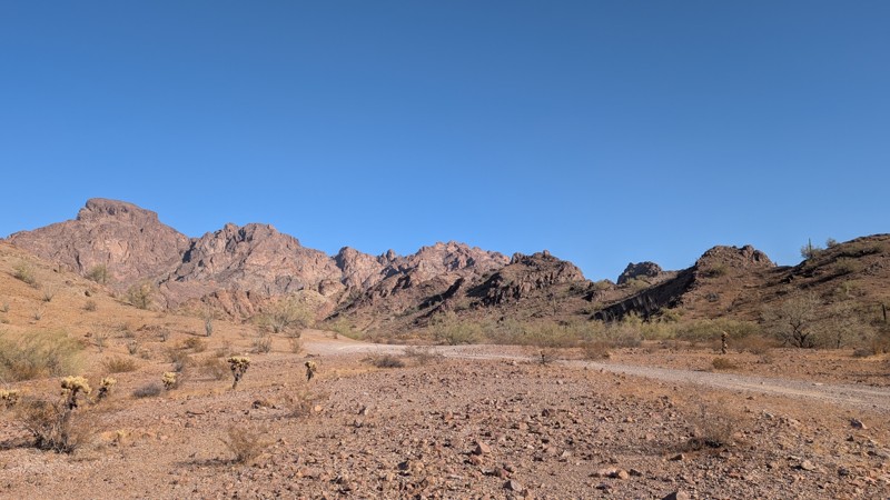
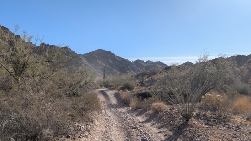
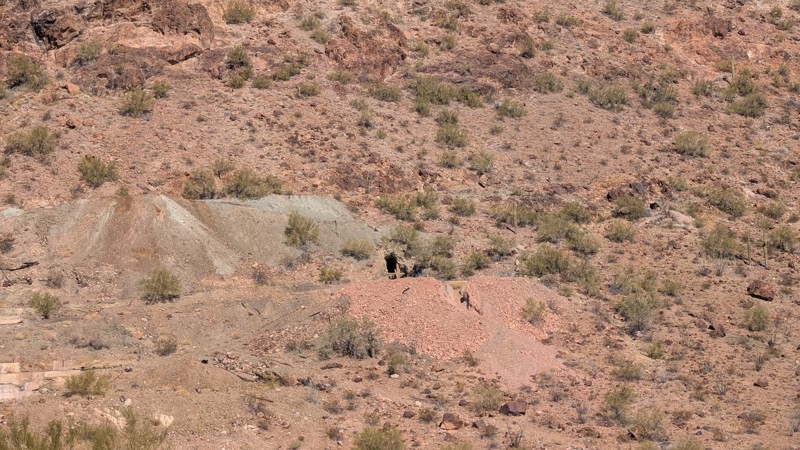
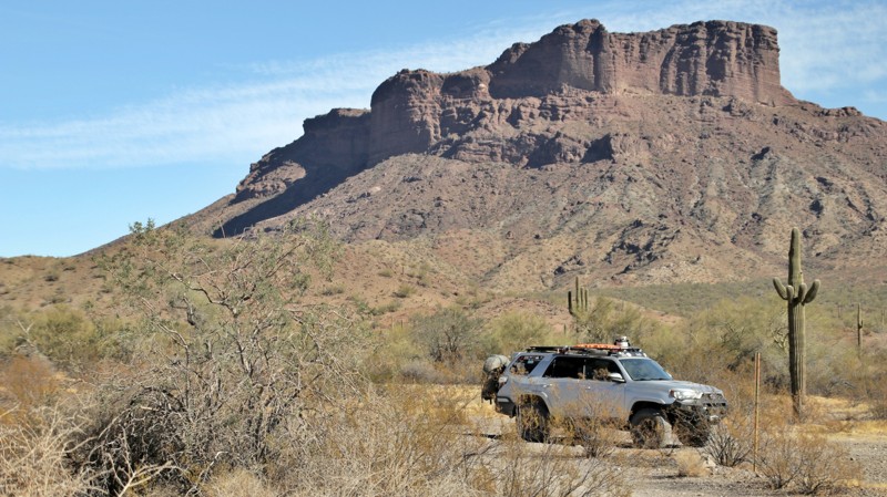
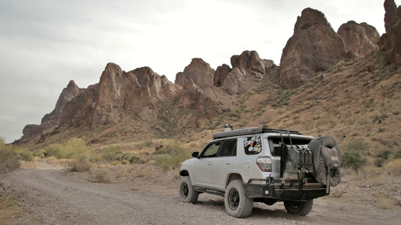
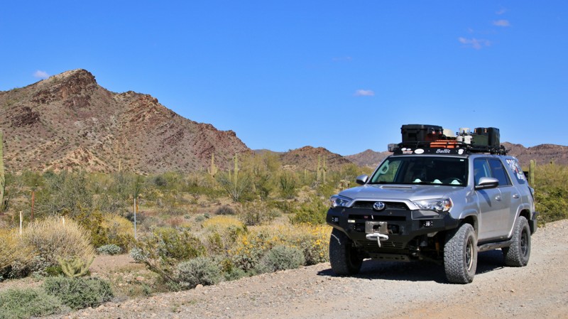
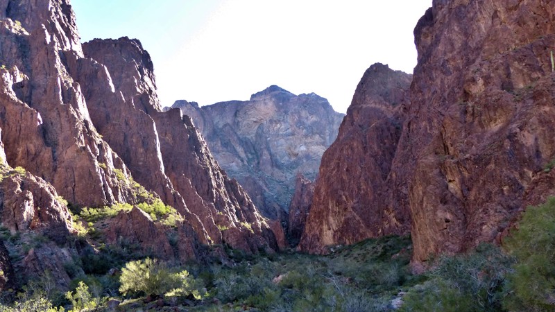
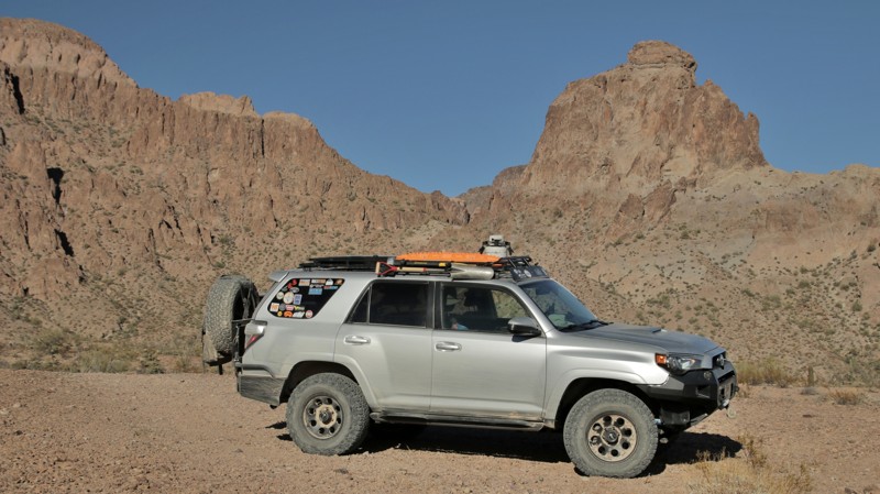
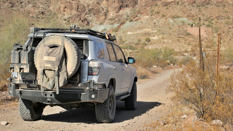
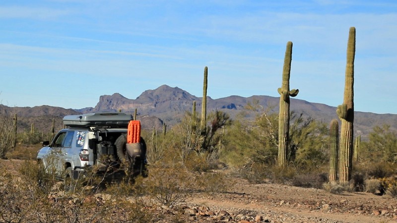
Before long, Engesser begins its slow rise to the mountain pass that gives the trail its name. Cutting through the ruggedly beautiful Kofa Mountains, the view westward from the pass is unsurpassed. The trail dives steeply to join Engesser Wash, brushy and sandy, as it slolams down and out of the mountains. Turning northward, Engesser parallels the colorful west side of the ancient volcanic Kofas. To the west across the broad King Valley lies the Castle Dome Mountains, the round spire of Castle Dome clearly identifiable. Engesser Pass ends near the King of Arizona mine, whose initials gave became the name of the area. 
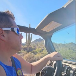
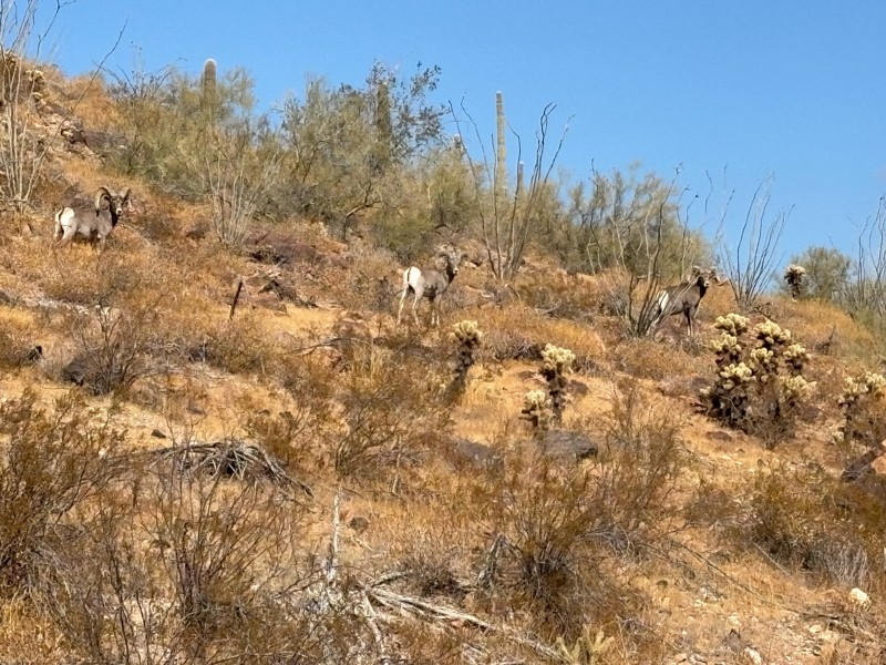
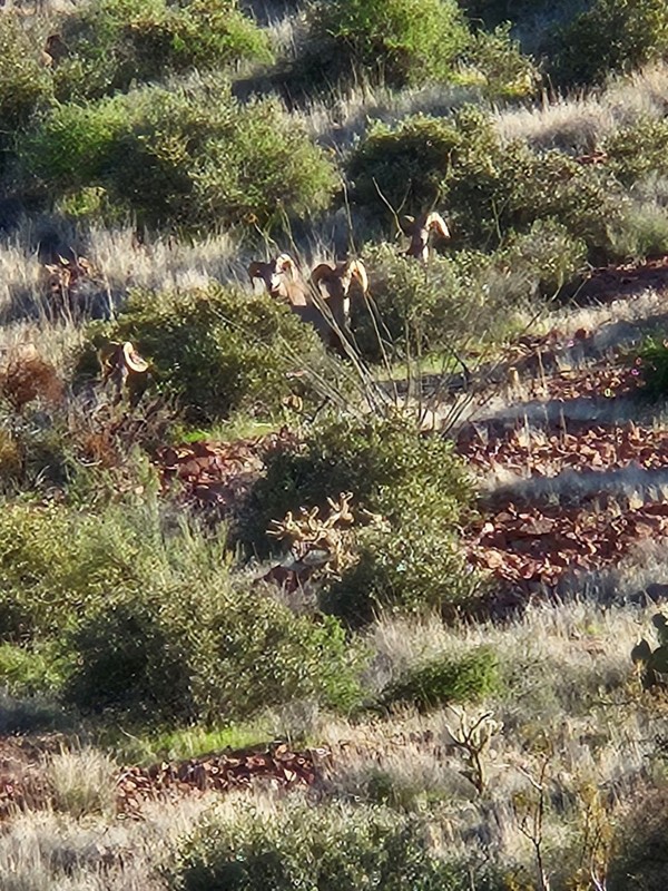
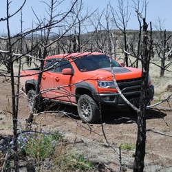
It is far more likely that you will see a desert bighorn sheep, the reason for the refuge's existence, or perhaps a tiny kit fox than it is you'll see another human on your traverse of Engesser Pass. Solitude. Beauty. Good wheeling. All fine reasons to explore one of Arizona's most remote trails.

Arizona: McPherson Pass Hero Photo
All-Access Icon
4.7/5 (14 reviews)
Updated: 03/01/2024
McPherson Pass
Quartzsite, Arizona

McPherson Pass connects the broad King Valley with the very flat Castle Dome Plain by crossing the low but ruggedly beautiful Castle Dome Mountains. The entire trail is inside the remote and sparsely visited Kofa National Wildlife Refuge, the second-largest wilderness area in Arizona. The trail crosses broad scenic valleys, pushes through a sandy wash, and climbs through a majestic mountain pass. The best part of all that is that along the way, you are likely to encounter more desert bighorn sheep than people. The Lower Sonoran Desert of this part of southwestern Arizona receives very little rainfall. That doesn't mean life is not abundant here. Both plants and animals have adapted to the harsh environment. Cacti include the stately saguaros and spindly ocotillo called fire sticks by natives for their bright red flowers, which seem to pop out purely randomly. Several species of cholla cactus call this area home. The teddy bear cholla looks cute, but the spines stick like velcro on steroids and hurt like Hades. Owls, various hawks, doves, and hummingbirds abound. Small mule deer hang close to the few available water sources. Coyote serenades at night are common. But the reclusive desert bighorn sheep reign supreme here. The entire purpose of the Kofa NWR was to preserve habitat for the surefooted mountain denizens. Keep your eyes on the slopes, and you might catch a glimpse of a few of them near McPherson Pass.

Arizona: Hovatter Road Hero Photo
All-Access Icon
4.6/5 (8 reviews)
Updated: 03/17/2024
Hovatter Road
Quartzsite, Arizona

Ray Hovatter patented mining claims in the Little Horn Mountains around 1950. Ray and his workers built a coarse road connecting the Hovatter homestead to the Harquahala mining district. Ray, his wife Barbara, and three daughters lived at their remote homestead from 1951 to 1974, managing and working the mines that produced mostly manganese. Barbara kept a glass jar of captured scorpions on the kitchen table and planted extensive cactus gardens at the homestead. A propane tank explosion killed the eldest daughter in 1968. Ray died on the property in 1974. Both a buried on the ridge just south of the homestead. Barbara's ashes were scattered over the graves in the 1990s. The site was reclaimed by the KOFA National Wildlife Refuge, and all the buildings were removed. The cactus gardens and a unique saguaro-lined driveway remain. Today the Hovatter road is a path to beauty. Rugged enough to keep the faint of heart at bay, a trip along the Hovatter rewards the intrepid with solitude and adventure. The trail begins as a smooth but very sandy road aimed southwest and straight at the prominent Coyote Peak. To the south, across a broad plain of saguaro cactus and creosote bush, the jagged multihued outline of the rugged Little Horn Mountain range hints at the adventure ahead. A slight left turn at Coyote Peak points you straight at the heart of the Little Horns, and soon the road obligingly begins a gentle climb. That gentleness is fully wrung out of the trail after you cross the first of the mountain passes. The Hovatter twist climbs, descends, and crosses rocky washes while providing geologic eye candy as it traverses the Little Horns. Keep an eye to the right for Conflagration Arch, a twisted testament to the powerful forces that raised these mineral-rich mountains. Massive saguaros find precarious perches on the edges of steep cliffs. A keen eye may spot desert bighorn sheep clattering up steep grades. The remnants of old mines dot the wild landscape. A small kiosk and old signage signal you are leaving BLM land and entering the KOFA National Wildlife Refuge, set aside by Presidential decree in 1939 and expanded over the years with the mission of providing habitat for those bighorn sheep you may or may not have seen. From the kiosk, it is just a short way to the Hovatter homestead and its saguaro-lined driveway. The homesite is a fantastic place to camp. If you do, walk up the hill and pay your respects to Ray and the family. Then kick back and imagine living out here in this remote, rugged, and beautiful part of Arizona.

Arizona: King Road Hero Photo
All-Access Icon
3.8/5 (9 reviews)
Updated: 03/02/2024
King Road
Quartzsite, Arizona

Charles E. Eichelberger discovered gold in an unnamed string of low rugged mountains in southwestern Arizona in 1986. The resulting mine was named the King of Arizona Mine. Rail shipments of supplies and equipment were brought in by wagon over Engesser Pass, the nearest rail siding being over 50 miles away. Soon the crates of gear and supplies were simply marked K of A, the mine's initials. The acronym stuck and soon, the entire area was simply known as Kofa. The short-lived mining town had 300 residents, a post office, and even a dam to store the runoff from limited seasonal rains. The gold rush in the area died off slowly in the early 1900s. In 1939 the Boy Scouts led an effort to preserve 666,640 acres in the area as habitat for desert bighorn sheep and other wildlife. Their efforts resulted in the Kofa National Wildlife Refuge, which covers four mountain ranges and vast low Sonoran Desert valleys. Today a wide dirt road crosses the broad King Valley ending at the entrance to the mine, which is on a small island of private property and is sporadically operated today. King Road is used as the main western entrance into the Kofa National Wildlife Refuge. While an easy drive, the road offers scenic views of the Kofa Mountains to the northeast and the Castle Dome Mountains to the southwest. Looking northeast, you can easily spot Kofa Butte, a steep-sided flat-top promontory. King Road ends near Kofa Butte.

Arizona: Wilbanks Road Hero Photo
All-Access Icon
4.4/5 (10 reviews)
Updated: 04/05/2024
Wilbanks Road
Quartzsite, Arizona
Surrounded by mountains, Saguaro and Ocotillo, your adventure begins in the middle of nowhere, deep in the Kofa National Wildlife Refuge. Wilbanks Road is a rugged overland drive through the inner sanctum of one of the more scenic and unique mountain ranges in the Arizona Desert, the Kofa Mountains. The heart of the experience lies in knowing that you are far from services, far from civilization, and far from help if something goes wrong. Combine this road with the others in the area for a truly unique off-road adventure through a seldom-used and wild landscape known as Kofa.
Arizona: Kofa Queen Canyon Hero Photo
All-Access Icon
4.5/5 (8 reviews)
Updated: 02/23/2024
Kofa Queen Canyon
Quartzsite, Arizona

Every king needs a queen. Kofa got its name from the abbreviation for the large King of Arizona Mine. So it wasn't much of an imaginary stretch when prospectors named their small nearby mine the Kofa Queen. Today only the mineshafts and a few small stone walls remain where miners once toiled in the Kofa Queen. But the scenic sandy canyon that provided access to the mine back in the day now provides hikers and offroaders access deep into the Kofa Mountains. Beginning on the King Valley's vast plain, the trail marches relentlessly toward the low jagged ridgelines of the igneous Kofa Mountains. These are not gentle wind-sculpted sandstone bluffs. Rather these edifices were violently created from near-molten heavy minerals violently pushed up from deep below the earth's mantle, bringing with them the precious gold, silver, and manganese that the miners came here to find. Today those formations are valued for their rugged, angular beauty by the hardy folk who venture here. Dropping into the wide sandy canyon takes you into the depth of the mountains. Formations in many improbable shapes surround you. Scary Skull Rock is just one apparition formed by the immeasurable forces that created this landscape. Side canyons invite you to explore deeper on foot. The many campsites beckon you to spend time and take it all in. The trail ends near the site of the Kofa Queen Mine. The Kofa Mountains gave the miners gold. What will the mountains and Kofa Queen Canyon give you?

Arizona: Hoodoo Wash Hero Photo
All-Access Icon
4.6/5 (5 reviews)
Updated: 02/11/2023
Hoodoo Wash
Quartzsite, Arizona

Early pioneers, mostly miners and ranchers, used broad sandy washes as ready-made roadways through the rugged landscapes of southwestern Arizona. A perfect example of that pioneer ingenuity is the use of a convenient section of Hoodoo Wash as a route into the edges of the rugged Kofa Mountains. The Wilbanks family settled on the western end of Hoodoo Wash, building a fine home and raising cattle. Their story is one of gritty determination to overcome the obstacles thrown their way. Their house burned, and they rebuilt the two-room cabin you see today. The Great Depression crashed cattle prices. Drought and flash floods took their toll. Severe injuries meant several days on rough roads to find medical care. Only the determined last in the Kofa Mountains. Later the Hoodoo Cabin was erected on the eastern end of Hoodoo Wash as a line shack for a cattle company. The cabin was modern for its time and came in prebuilt segments to be assembled onsite. You can still see the numbered medallions that identified each section so the assembly instructions could be followed. Working cattle this far out was a lonely affair, but at least it was comfortable. Narrow roadways have been built where required, but the trail between the cabins is mostly in the wide sandy Hoodoo Wash. Wells at both cabins, and one along the way, still pump water via windmills to fill water troughs for local wildlife, which includes among others desert bighorn sheep, deer, fox, and coyotes. Palo verde and mesquite grow in thick tangles on the edges of the wash, while stately saguaros stand as silent sentinels on the rocky slopes above. Saguaros live for hundreds of years. The ones you see today watched the Wilbanks come and go. They have seen prospective miners combing the slopes for mineral veins only to vanish into history. Cowboys have ridden under the silent sentinels only to disappear from the area as well. They will watch you drive the sandy wash as you search for whatever brought you into the remote and rugged Kofa Mountains.

Arizona: Big Eye Mine Trail Hero Photo
Scout Route Icon
4.9/5 (7 reviews)
Updated: 03/07/2025
Big Eye Mine Trail
Yuma Proving Ground, Arizona

The Big Eye Mine trail is an out-and-back two-track road that winds through the rugged Kofa National Wildlife Refuge. Most of the trail is relatively easy, but there are sections where high clearance would be helpful but unnecessary.  This trail has multiple sandy or loose gravel wash crossings and some driving in a wash bottom. There are some sections with exposed rocks. Heavy rain could easily affect the trail's condition, and several areas show erosion and ruts from recent weather. 

There are multiple flat camping spots along the entire trail. 

The Kofa NWR has beautiful scenery, endless Teddy Bear Cholla, Saguaro cacti, and 360-degree mountain views, including Thumb Butte. At the trail's end is a 1/2-mile hike to a cabin and other structures associated with the Big Eye Mine.

Arizona: MST&T Hero Photo
All-Access Icon
4/5 (3 reviews)
Updated: 01/21/2023
MST&T
Quartzsite, Arizona

MST&T provides a scenic gateway into the northwestern portion of the 1042 square mile Kofa National Wildlife Refuge. In 1939 this area was designated the Kofa National Wildlife Refuge after an extensive effort by the Arizona Boy Scouts. The purpose of the refuge was to secure habitat for a decreasing population of desert bighorn sheep. Today the desert bighorns are flourishing in the rugged mountain ranges found in the sanctuary. However, you are more likely to see mule deer along the MST&T since most of the road traverses a broad desert valley filled with stately saguaro and prickly cholla cacti. Ironwood and paloverde trees line the numerous sandy washes. Years ago, Mountain States Telephone and Telegraph (MST&T) operated a microwave tower on a hilltop in the Livingston Hills at the end of this road. Today, the tower is gone, but a caretaker trailer and a picnic table remain. The reward for a drive to the top is fantastic views of the northern portion of the vast Kofa National Wildlife Refuge. Kofa is famous for amazing sunsets. Viewing one from this vantage point is a special treat. You can even camp on top of the hill.

Arizona: Norton Road Hero Photo
All-Access Icon
4/5 (2 reviews)
Updated: 06/05/2022
Norton Road
Quartzsite, Arizona

We had long discussed finding a passage that skirted the northeastern corner of the Yuma Proving Grounds. Crossing the Proving Grounds was a no-go for obvious reasons -- no trespassing signs, unexploded ordinance, live weapons firing, and possible death, to name just a few. This trail is called Norton Road because it begins on Norton Road. But Norton eventually goes directly into the Proving Grounds and, in effect, ends at the associated no trespassing sign. So we turn east onto a remnant of the old Red Raven Road and follow it until cornering south on BLM road YE08 and then veering southeast on BLM YE043 at the eastern end of the Tank Mountains. Confusing, isn't it? Not really. Just follow the track, check off the waypoints, and enjoy the adventure! Simply getting to the trailhead on Hovatter Road is a scenic adventure. Norton Road drops out of the ruggedly beautiful Little Horn Mountains onto the broad Palomas Plain, a wide flat valley of stately saguaro, firestick ocotillo, and the omnipresent creosote bushes. The plain is cut by washes large and small, all thickly lined with palo verde, mesquite, and other thorny shrubs, all eager to add more pinstriping to your rig. To the south, hills comprised entirely of jet-black basalt boulders rise ominously from the otherwise level Palomas Plain. Our trail ends by intersecting with the Palomas Harquahala Road, another great trail running through the Palomas Plain up to the Eagletail Wilderness and beyond. Now there is a proven route around the Proving Grounds. All that is left is for you to go explore it. Enjoy.

Arizona: Blevens Road Hero Photo
All-Access Icon
3.6/5 (8 reviews)
Updated: 03/02/2024
Blevens Road
Quartzsite, Arizona

The tremendous heat and pressure form gold, other heavy minerals, and most semiprecious stones deep under the earth's surface. Sometimes, that pressure forces its way to the surface through faults, bringing rare minerals and stones. Such forces formed the Kofa Mountains and the various surrounding mountain ranges. Gold and other valuable minerals lured fortune-seeking prospectors and miners to these mountains in the mid-1800s. Today, most of the mines are inactive. However, mild winters lure visitors to Quartzsite and its broad valleys and rugged mountains. Some visitors drive Blevens Road to Crystal Hill to scratch through the multi-hued soil on its slopes in search of a wide variety of rare stones. Even if you are not a gem collector, Blevens Road offers an easy drive through a sand and gravel desert filled with saguaro, ocotillo, cholla, ironwood, jackrabbits, and hummingbirds. To either side are inspiring views of the Kofa and New Water Mountains. The openness of the desert makes for leisurely strolls to take in the austere beauty of this arid environment. The adaptability of animal and plant life deserves to be examined and understood at arm's length. Just don't step on a cholla ball.

Arizona: Red Raven Road Hero Photo
All-Access Icon
4.1/5 (7 reviews)
Updated: 03/25/2023
Red Raven Road
Quartzsite, Arizona

Back in the day, Red Raven connected all the major north-south roads in the area, including the Manganese, Hovatter, Norton, and Palomas Harquahala roads. The Red Raven was very useful for the few hardy ranchers and miners in the area back then. The creation of the Kofa National Wildlife Refuge caused the eventual closure of a section of the Red Raven. The Yuma Proving Grounds to the south further complicated travel in the area. For modern adventurers traversing the ruggedly beautiful Kofa, the remaining Red Raven section provides an important and scenic connection between the Hovatter Road and the Kofa Manganese Road. Paralleling Red Raven Wash, the trail crosses a plain dotted with stately saguaros, thorny cholla, and the omnipresent creosote bushes. To the north, the Little Horn Mountains create a colorful jagged horizon. In the west, the Kofa Mountains thrust skyward in wildly varying shapes. Wash crossings keep the driving experience interesting. Flat desert playas offer plenty of opportunities to make camp and enjoy the beauty and solitude of an area few will ever see. Dark skies reveal more stars than seem possible. Stargazing is even more magical when accompanied by serenading coyotes. Sometimes a simple road is more than just a road.

Arizona: Polaris Mountain Hero Photo
All-Access Icon
4.6/5 (5 reviews)
Updated: 03/02/2024
Polaris Mountain
Quartzsite, Arizona

Polaris Mountain is a pyramid-shaped promontory in the northern portion of the Kofa Mountains. From the Kofa mining district, this mountain pointed straight up to the star Polaris, thus the name. A short and scenic side road off King Road takes you to the base of Polaris Mountain and into Big Dick Canyon. The end of the trail has wonderful mountain views and a great vista back across the broad King Valley. It's also a great jumping-off spot for some off-trail hiking into the rugged Kofa Mountains.

Arizona: Polaris Hero Photo
All-Access Icon
4.4/5 (8 reviews)
Updated: 03/02/2024
Polaris
Quartzsite, Arizona

The southwestern Arizona mining camp of Polaris sprung up in the early 1900s to support the large North Star Mine. By June 1909, the town had its own post office and a peak population of nearly 2,000. The North Star Mine had two primary shafts tracking quarts veins rich in gold ore. The mine operated its own stamp mills to process the ore and used cyanide to extract the gold from the crushed ore. By 1914 the mine had slowed its operations, the town shrank, and the post office was discontinued. Today one lone building stands where the town once was, and the impressive remnants of the mine loom up the mountainside. The mine is on private property, but visitation is allowed. Always be careful around old mines. Look up and to the right of the mine along the ridgeline and see if you can spot the natural arch.

Arizona: Palm Canyon Hero Photo
Scout Route Icon
4.2/5 (5 reviews)
Updated: 03/31/2025
Palm Canyon
La Paz Valley, Arizona
Palm Canyon leads off Highway 95 into the vast Kofa National Wildlife Refuge to a difficult hike into the only place in Arizona where native California palm trees grow in their natural habitat. The road is well maintained and a very popular area for boondockers during the mild Arizona Winter. While there's no shade, there is plenty of level ground to support any type of rig for a few pleasant nights under the stars. One of the most popular offroad trails in the Refuge, Kofa Queen Canyon, branches off the road into a picturesque canyon. With plenty of time on their hands, some campers created a perfect spiral of rocks visible by satellites. Check out these coordinates, 33.373263, -114.173820, on Google Earth!
Arizona: Cibola Road Hero Photo
Scout Route Icon
4/5 (2 reviews)
Updated: 10/15/2024
Cibola Road
La Paz Valley, Arizona

Cibola Road crosses the Army's Yuma Proving Ground between Highway 95 and the Ehrenberg Cibola Road. Before starting the road, call the Proving Ground at 928 328-2047 for permission to enter. There is signage on the road's eastern end with information about entering the probing ground. The western end does not have signage. The Proving Ground may refer to the road as Cibola Lakes. Permission is granted unless there is a test in the area involving explosives. Do not leave the roadway as the area has not been fully cleared of unexploded ordinance. Thus, there is no camping on the trail.

On the eastern end, the road is wide and well-graded. Midway through, the trail becomes sandy and rough as it follows Mojave Wash through the Trigo Mountains. 4WD is recommended due to the deep sand.


Arizona: Charco Four Hero Photo
Scout Route Icon
3.3/5 (3 reviews)
Updated: 10/15/2024
Charco Four
Vicksburg, Arizona
Though named for the well and windmill at its end, Charco Four is known mostly as an easy entrance into the remote, vast, and rugged Kofa National Wildlife Refuge. Charco Four begins at Exit 45 off Interstate 10. The exit is a good place to gas up and air down. Charco Four is graded but washboarded as it travels straight south. Just a bit over five miles, the road departs BLM land and enters the Refuge. There's an informative kiosk at the border. At eight miles, Charco Four intersects El Paso Pipeline Road which leads to many of the better Kofa trails. Going straight ahead takes you to an old corral. Today the well here is used to fill troughs for game water as a part of the Refuge's wildlife habitat program. There are a few opportunities to camp along the road. However, excellent dispersed campsites are beyond plentiful in the Refuge.
Arizona: High Tank Six Road Hero Photo
All-Access Icon
4.5/5 (4 reviews)
Updated: 09/23/2023
High Tank Six Road
Quartzsite, Arizona

Located in the northern portion of the vast 1042 square mile Kofa National Wildlife Refuge, High Tank Six Road serves as a connector between the easily traveled MST&T and the more rugged Kofa Cabin - Jasper Springs. But don't let the short length of this trail nor its lowly status as a connector fool you. High Tank Six Road winds through a lower Sonoran Desert landscape of stately saguaro cacti, evil cholla cacti, and dry washes lined with ironwood trees. The ironwoods are a protected species, and if you value your ax, saw, or knife, you won't try to cut into one. They are called ironwoods for a reason. The Kofa Mountains form a jagged horizon to the south, home to desert bighorn sheep. To the north lies the lower Livingston Hills. These make great backdrops for camping along High Tank Six Road. Toss in a beautiful Arizona sunset, and you'll be in for a memorable experience in the Kofa National Wildlife Refuge.

Arizona: Horse Tanks Hero Photo
Scout Route Icon
4.8/5 (4 reviews)
Updated: 03/11/2025
Horse Tanks
Yuma Proving Ground, Arizona
The rarity of water in the desert has always drawn us. In the arid Sonoran Desert, runoff from steep rocky hillsides can erode swimming pool-sized tanks into the bedrock, thus storing water from the infrequent rains. One collection of these pools is named Horse Tanks. Mountain bighorn sheep living in the Kofa National Wildlife Refuge often water here. There are even grind holes and a few petroglyphs from ancient native American tribes that once inhabited this area. Today, there are no permanent inhabitants, but campers inhabit the numerous campsites along the road leading to the Horse Tanks during the area's mild winters. Besides camping and the lure of the tanks, the geology on display near Horse Tanks and the nearby Gray Tanks will keep you wondering just how those rocks got that way.
Arizona: AT&T Frontage Road Hero Photo
Scout Route Icon
4/5 (1 reviews)
Updated: 10/15/2024
AT&T Frontage Road
Sunwest, Arizona

Named for the now unused three strands of telephone wire atop the poles along the north section of the trail, AT&T Frontage Road runs from I-10's Exit 55 to the El Paso Gas Pipeline Road. The graded trail provides access to a vast BLM land holding and the nearby Kofa National Wildlife Refuge. There is a huge campsite near the southern end.

Arizona: Connector Road Hero Photo
Scout Route Icon
2/5 (1 reviews)
Updated: 10/15/2024
Connector Road
Sunwest, Arizona

Connector is aptly named. It offers connections to a variety of area trails and not much else. While graded, the sand is extremely deep, making 4WD highly advisable. The trail does pass the extreme southern end of the long-abandoned Salome Emergency Airfield. The end of the runway provides a unique campsite and one of the very few along the trail.

Arizona: Vinegarroon Road Hero Photo
Scout Route Icon
5/5 (1 reviews)
Updated: 10/15/2024
Vinegarroon Road
Salome, Arizona

The giant North American vinegaroon scorpion, Mastigoproctus giganteus, was first described in 1835 and has been known to live across various habitats in Florida, Texas, Arizona, and central and northern Mexico. And there is a Vinegarroon Road in Arizona. The well-graded road travels south from I-10's Exit 55, past the abandoned Salome Emergency Airfield. Built in the 1930s, the dirt airstrip with two runways set in a cross pattern oriented north/south and east/west was available for early commercial airliners flying between Los Angeles and Phoenix. Closed in 1956, nothing but the hard-packed dirt runways remain. They make decent campsites, though thoughts of a vinegaroon slipping into your sleeping blanket might not make for the most restful night.